Cemetery in Barberier
Cemetery
| Town : | Barberier (Allier) |
| Address : | Route d'Etroussat (D36) |
| Type : | Cemetery |
| Position : | 46.219177°N, 3.240979°E |
| Winter closure : non | |
| Ce point d'eau a été ajouté par Erwan F en 2022 | |
Further information
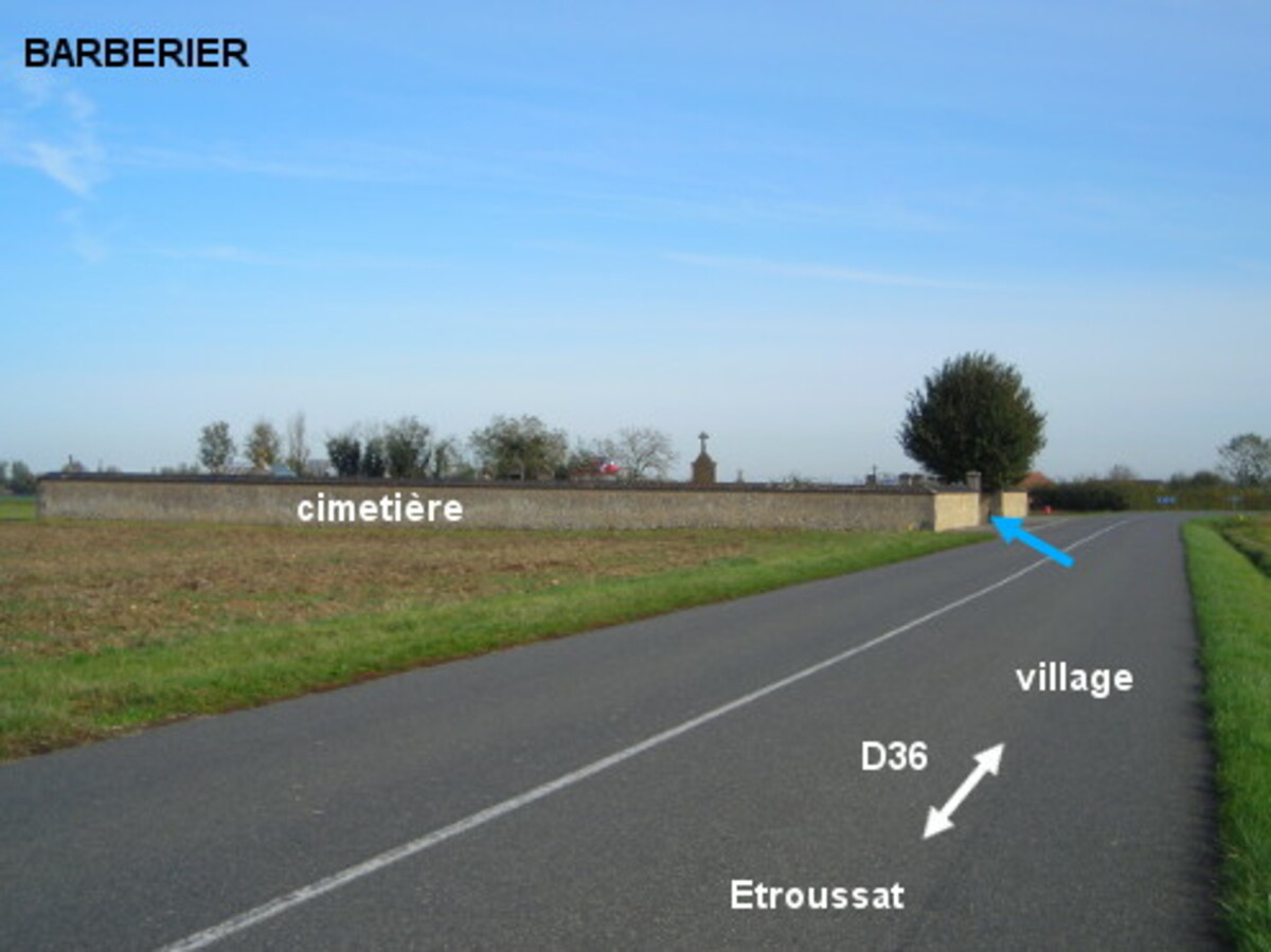
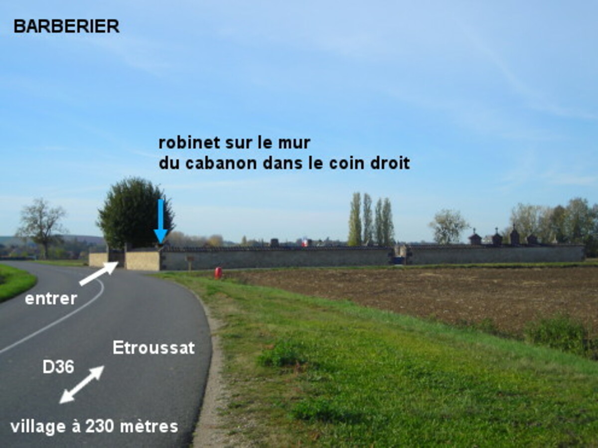
Le cimetière implanté au bord de la D36 est situé en dehors du village. 1) Sur la D36 en provenance d'Etroussat, 100 mètres après le point kilométrique 20, entrer dans le cimetière implanté côté gauche et se diriger vers le coin avant droit pour trouver le robinet fixé sur le mur d'un cabanon bas situé dans le coin. 2) En provenance du village, 230 mètres après le panneau de fin, au sortir d'un virage, on sera devant le portail principal qui donne sur la route. P.S. : Au cas où le portail serait cadenassé par un câble antivol, rentrer par le portillon sur le mur latéral droit et se diriger vers le coin à gauche.
Visual cues
Want to add a testimonial ?
There's no comment yet
Information
Warning: this site lists water points whose reliability can not be guaranteed. Before using a water point, you must ensure that there is no sign indicating that the water is not drinkable and do not infringe on private property.
If you find that no water is not potable, or not accessible, thank you to report it so that it is removed from the site.
If you find that no water is not potable, or not accessible, thank you to report it so that it is removed from the site.