Cemetery in Mazerier
Cemetery
| Town : | Mazerier (Allier) |
| Address : | Route de Saint-Bonnet-de-Rochefort (D37) |
| Type : | Cemetery |
| Position : | 46.124532°N, 3.189163°E |
| Winter closure : non | |
| Ce point d'eau a été ajouté par Erwan F en 2022 | |
Further information
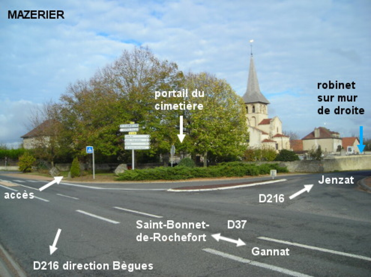
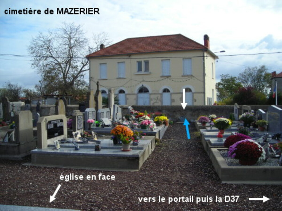
Le cimetière est situé dans l'angle de la D37 direction Saint-Bonnet-de-Rochefort et de la D216 direction Jenzat, il est implanté autour de l'église. Sur la D216 en provenance de Bègues, au carrefour avec la D37 tourner à gauche puis juste après la suite de la D216 qui part à droite en direction de Jenzat, entrer à droite sur l'allée qui conduit au portail du cimetière (15 mètres au milieu d'un espace arboré). Entrer, parcourir 15 mètres sur l'allée très gravillonnée puis prendre la première allée à droite après le muret jusqu'au mur de droite (10 mètres) pour trouver le robinet sur ce mur (à peu près dans l'axe du portillon sur le mur de gauche qui est à côté de l'église et qui est au fond de la place T. Voudable).
Visual cues
Want to add a testimonial ?
There's no comment yet
If you find that no water is not potable, or not accessible, thank you to report it so that it is removed from the site.