Cemetery in Saint-Bonnet-de-Rochefort
Cemetery
| Town : | Saint-Bonnet-de-Rochefort (Allier) |
| Address : | Chemin du Puy de la Reine |
| Type : | Cemetery |
| Position : | 46.151629°N, 3.135212°E |
| Winter closure : oui | |
| Ce point d'eau a été ajouté par Erwan F en 2023 | |
Further information
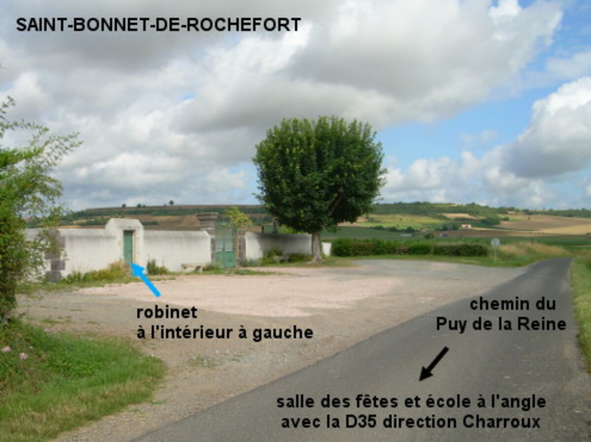
Le cimetière (fléché) est situé dans une rue secondaire, à 370 mètres de la D35 direction Charroux. A partir du rond-point D35 / D37, prendre la D35 direction Charroux et 200 mètres plus loin tourner dans la première à gauche, entre une école et la salle des fêtes. Le cimetière est implanté côté gauche 370 mètres plus loin, très en retrait par rapport à la route, et ne se voit qu'au dernier moment à cause d'une haie arbustive avant lui. Entrer par le portillon situé à gauche au début du mur, pour trouver le robinet à l'intérieur sur la gauche.
Visual cues
Want to add a testimonial ?
There's no comment yet
Information
Warning: this site lists water points whose reliability can not be guaranteed. Before using a water point, you must ensure that there is no sign indicating that the water is not drinkable and do not infringe on private property.
If you find that no water is not potable, or not accessible, thank you to report it so that it is removed from the site.
If you find that no water is not potable, or not accessible, thank you to report it so that it is removed from the site.