Cemetery in Saint-Rémy-en-Rollat
Cemetery
| Town : | Saint-Rémy-en-Rollat (Allier) |
| Address : | Rue des Augerolles / rue de Gravière |
| Type : | Cemetery |
| Position : | 46.188395°N, 3.391775°E |
| Winter closure : oui | |
| Ce point d'eau a été ajouté par Erwan F en 2022 | |
Further information
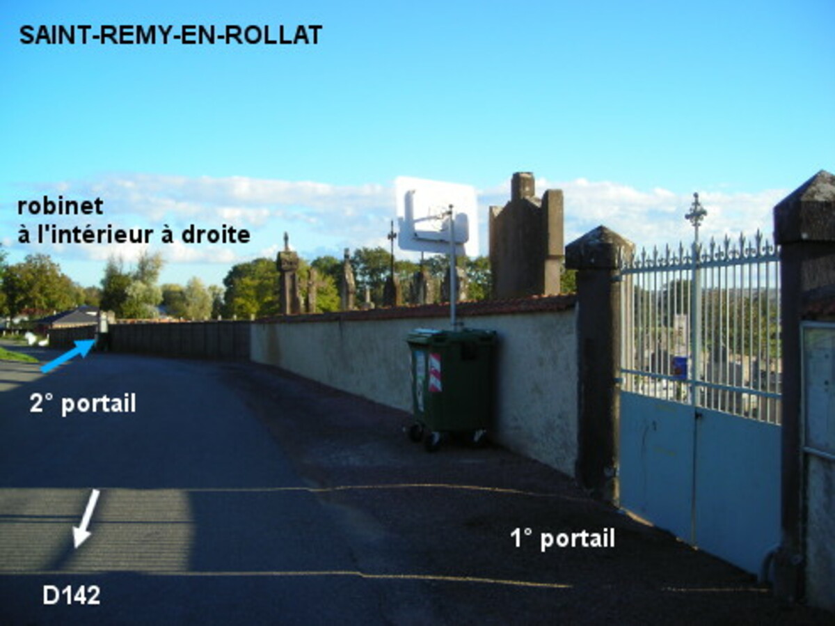
Le cimetière est situé dans une rue secondaire, à 400 mètres de la D142. En provenance de la D220 ou de la D520, à partir de l'église au centre du village et au bord de la D6, prendre la D142 direction Marcenat puis peu après tourner dans la première à gauche en direction du cimetière. Celui-ci est implanté plus loin côté droit derrière l'angle avec une rue adjacente. Entrer par le deuxième portail (celui de gauche) pour trouver le robinet à l'intérieur sur la droite.
Visual cues

Want to add a testimonial ?
There's no comment yet
Information
Warning: this site lists water points whose reliability can not be guaranteed. Before using a water point, you must ensure that there is no sign indicating that the water is not drinkable and do not infringe on private property.
If you find that no water is not potable, or not accessible, thank you to report it so that it is removed from the site.
If you find that no water is not potable, or not accessible, thank you to report it so that it is removed from the site.