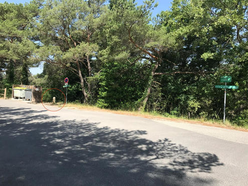
Fountain in Mimet
Fountain
| Town : | Mimet (Bouches-du-Rhône) |
| Type : | Fountain |
| Position : | 43.411252°N, 5.491822°E |
| Winter closure : information unknown | |
| Ce point d'eau a été ajouté par Benoit V en 2019 | |
Further information
Comme son nom l'indique le robinet se situe au sommet de la terrible côte de la Glacière (Chemin de Pignatelle, (Segment Strava : "Route de la Glacière")). Il est aussi accessible depuis Mimet par la route de Notre dame des Anges en direction du col Saint Anne. L'eau est très fraiche, ce qui est très agréable quand on vient de faire les 800m à 11%. Attention, ce robinet est aussi un lieu très apprécié des guêpes, mais elles ne sont pas très stressées dans cet environnement, donc restez calme et tout se passe bien !!!
Want to add a testimonial ?
There's no comment yet
Information
Warning: this site lists water points whose reliability can not be guaranteed. Before using a water point, you must ensure that there is no sign indicating that the water is not drinkable and do not infringe on private property.
If you find that no water is not potable, or not accessible, thank you to report it so that it is removed from the site.
If you find that no water is not potable, or not accessible, thank you to report it so that it is removed from the site.

