Cemetery in Marclopt
Cemetery
| Town : | Marclopt (Loire) |
| Address : | rue Charles de Gaulle / route du Châtelard |
| Type : | Cemetery |
| Position : | 45.664903°N, 4.222669°E |
| Winter closure : information unknown | |
| Ce point d'eau a été ajouté par Erwan F en 2021 | |
Further information
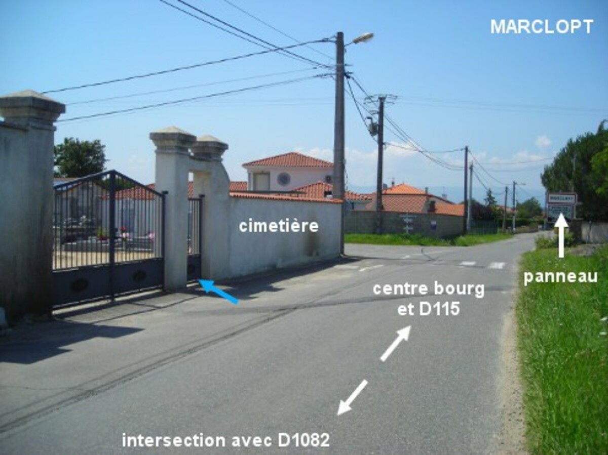
Le cimetière est situé à l'entrée du village au niveau du panneau de début et à l'angle d'un carrefour en croix. Il est implanté côté gauche sur la petite route que l'on prend à partir de la D112 à proximité de son intersection avec la D16 et qui traverse la D1082 (elle fait partie d'itinéraires de randonnées cyclistes balisés, mais ne comporte pas d'autres indications que son nom : route du Châtelard). Le robinet est à l'intérieur du cimetière, à gauche du portail qui est lui-même à gauche du portillon par lequel on peut entrer.
Visual cues
Want to add a testimonial ?
There's no comment yet
Information
Warning: this site lists water points whose reliability can not be guaranteed. Before using a water point, you must ensure that there is no sign indicating that the water is not drinkable and do not infringe on private property.
If you find that no water is not potable, or not accessible, thank you to report it so that it is removed from the site.
If you find that no water is not potable, or not accessible, thank you to report it so that it is removed from the site.