Cemetery in Saint-Régis-du-Coin
Cemetery
| Town : | Saint-Régis-du-Coin (Loire) |
| Address : | D28 |
| Type : | Cemetery |
| Position : | 45.281136°N, 4.448206°E |
| Winter closure : oui | |
Further information
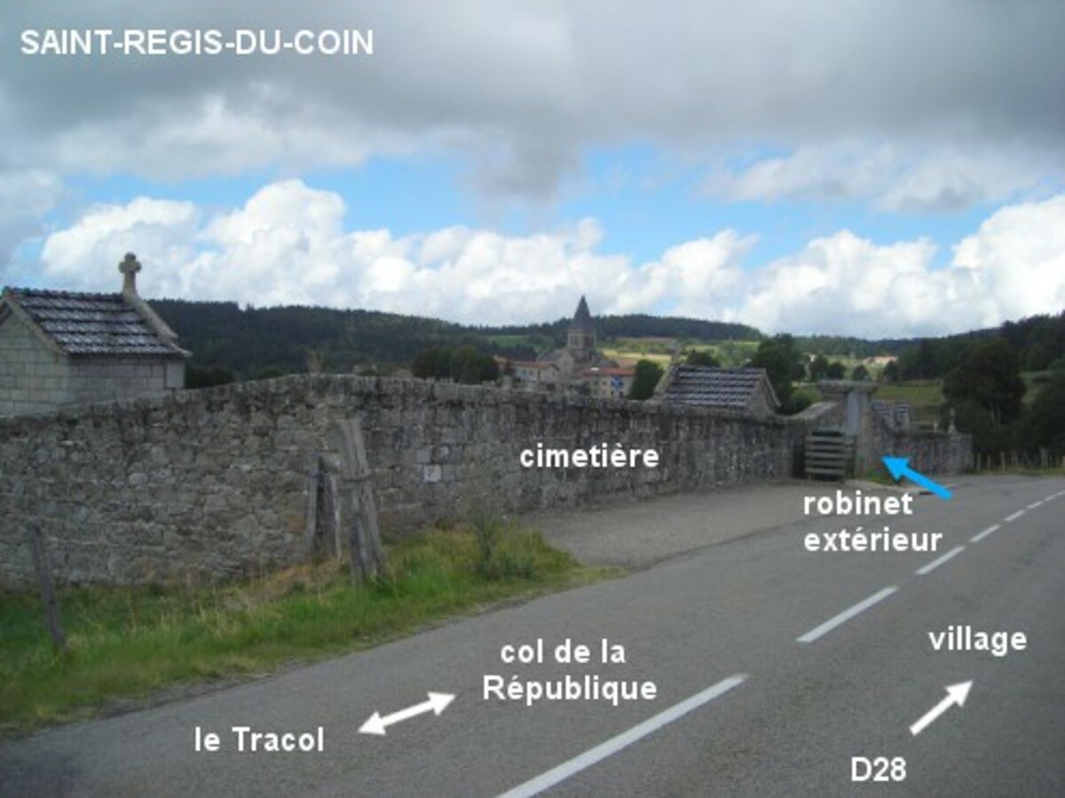
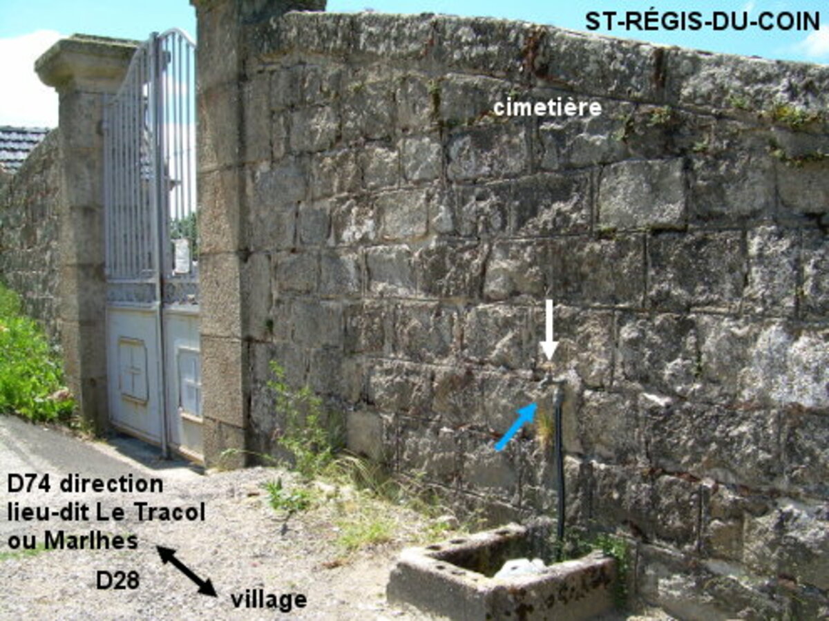
Le cimetière est situé en dehors du village, au sud sur la D28, quand on suit la flèche indiquant la direction de Saint-Sauveur-en-Rue (par la D503 à très grande circulation !). Le robinet est à l'extérieur, à droite du portail. 1) En provenance de Saint-Sauveur-en-Rue (prendre la D22 en direction du col de la République et 3 km après le carrefour D22 / D503, tourner à gauche dans la ''route de Morel'', puis au carrefour en T tourner à gauche, à la sortie du lieu-dit Les Clavassous au carrefour où il y a une croix prendre à gauche la ''route de Gimel'' qui descend : elle débouchera sur la D28, à prendre à droite) en passant par des petites routes pour rejoindre la D28, on arrivera peu après vers le cimetière implanté côté gauche, avant le village dont on aperçoit l'église au loin. 2) En provenance de Marlhes sur la D501 puis la D74 et enfin la D28, on arrivera de même vers le cimetière implanté côté gauche peu après avoir rejoint la D28. 3) En provenance de Saint-Genest-Malifaux sur la D22 puis la D28, traverser tout le village, 370 mètres après le panneau de fin de village on sera à côté du robinet du cimetière implanté côté droit.
Visual cues
Want to add a testimonial ?
There's no comment yet
If you find that no water is not potable, or not accessible, thank you to report it so that it is removed from the site.