Cemetery in Saint-Romain-la-Motte
Cemetery
| Town : | Saint-Romain-la-Motte (Loire) |
| Address : | D39 |
| Type : | Cemetery |
| Position : | 46.08166°N, 3.989526°E |
| Winter closure : oui | |
| Ce point d'eau a été ajouté par Erwan F en 2021 | |
Further information
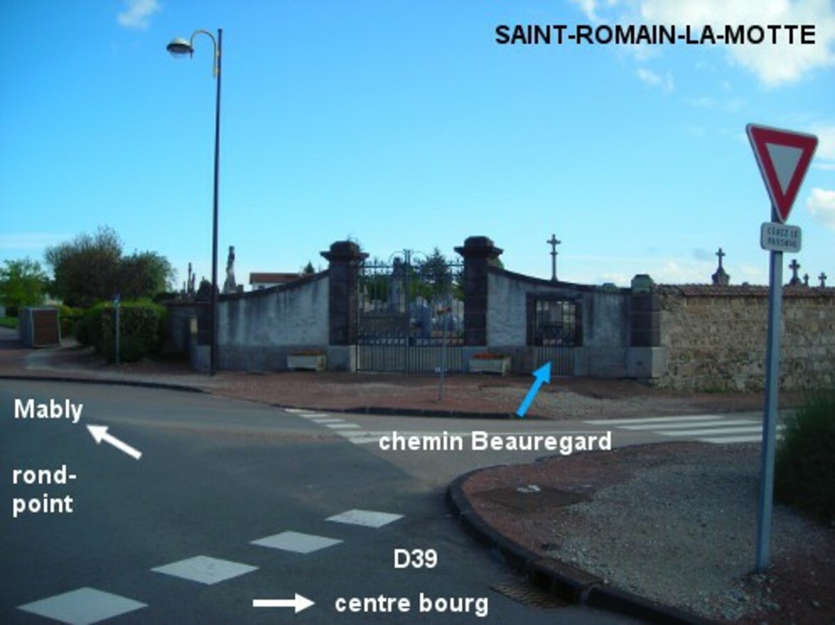
Le cimetière est situé à la sortie du village côté droit sur la D39 en direction de Mably, au niveau du rond-point sur la D39 (qui passe de "route de Trébende" à "route de Roanne"), il est implanté dans la fourche entre le "chemin Beauregard" et la "route du Puits Vert". Entrer à l'intérieur du cimetière par le portillon à droite du grand portail, à gauche de ce dernier il y a une borne verte pompe à eau (il faut tourner longtemps pour que l'eau coule).
Visual cues
Want to add a testimonial ?
There's no comment yet
Information
Warning: this site lists water points whose reliability can not be guaranteed. Before using a water point, you must ensure that there is no sign indicating that the water is not drinkable and do not infringe on private property.
If you find that no water is not potable, or not accessible, thank you to report it so that it is removed from the site.
If you find that no water is not potable, or not accessible, thank you to report it so that it is removed from the site.