Cemetery in Sainte-Sixte
Cemetery
| Town : | Sainte-Sixte (Loire) |
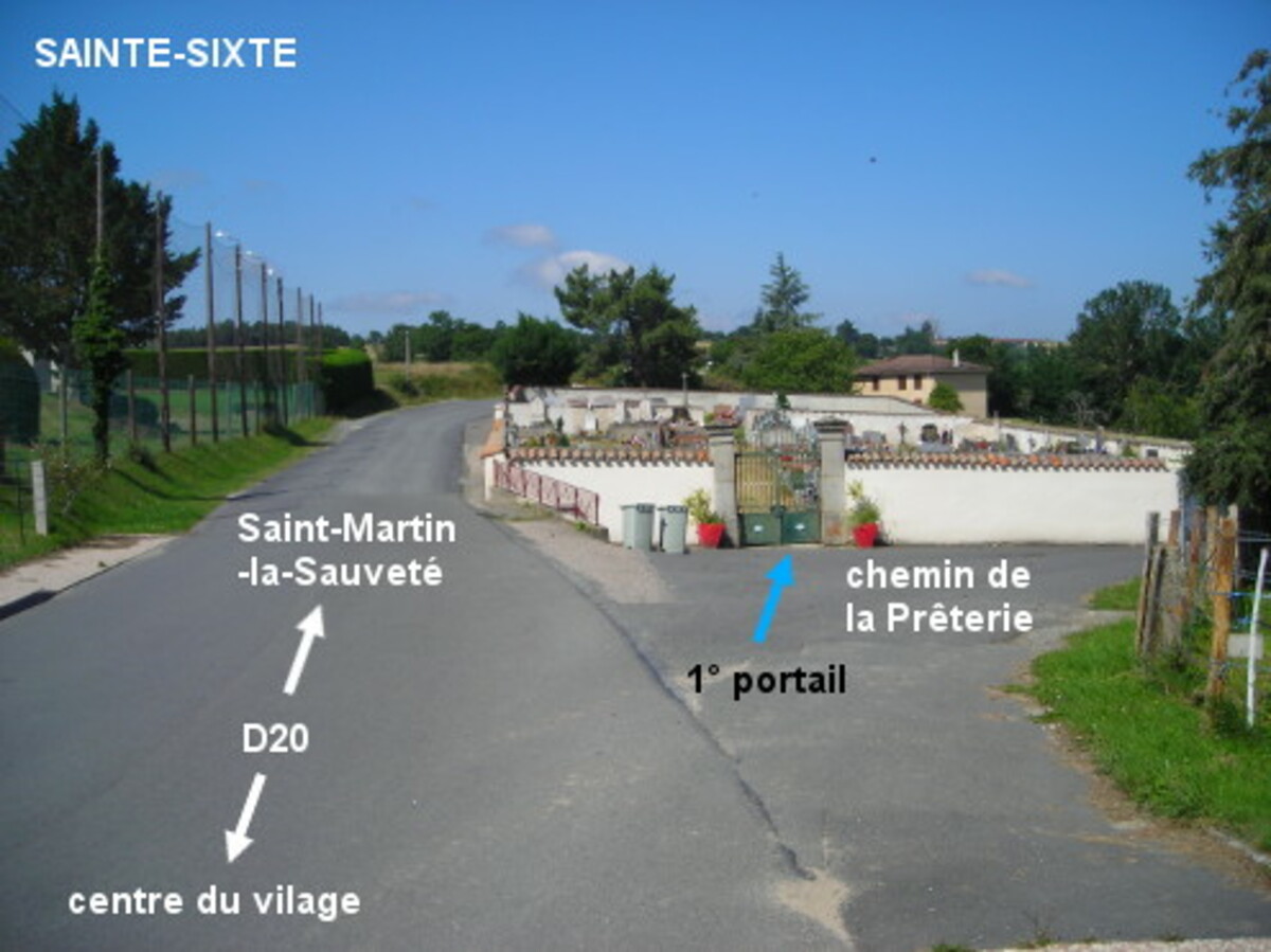
| Address : | chemin de la Prêterie / D20 |
| Type : | Cemetery |
| Position : | 45.775735°N, 3.978912°E |
| Winter closure : information unknown | |
| Ce point d'eau a été ajouté par Erwan F en 2021 | |
Further information
Le cimetière est implanté côté droit à la sortie du village sur la D20 en direction de Saint-Matin-la-Sauveté. Son premier portail est accessible par le chemin de la Prêterie (petite route à droite de la D20). Le robinet est à l'intérieur du cimetière à droite de ce portail. N.B.: Il n'y a pas de robinet à proximité du deuxième portail qui donne sur la route de Saint-Martin (D20).
Visual cues
Want to add a testimonial ?
There's no comment yet
Information
Warning: this site lists water points whose reliability can not be guaranteed. Before using a water point, you must ensure that there is no sign indicating that the water is not drinkable and do not infringe on private property.
If you find that no water is not potable, or not accessible, thank you to report it so that it is removed from the site.
If you find that no water is not potable, or not accessible, thank you to report it so that it is removed from the site.