Cemetery in Souternon
Cemetery
| Town : | Souternon (Loire) |
| Address : | rue Capus |
| Type : | Cemetery |
| Position : | 45.871151°N, 3.987768°E |
| Winter closure : oui | |
| Ce point d'eau a été ajouté par Erwan F en 2021 | |
Further information
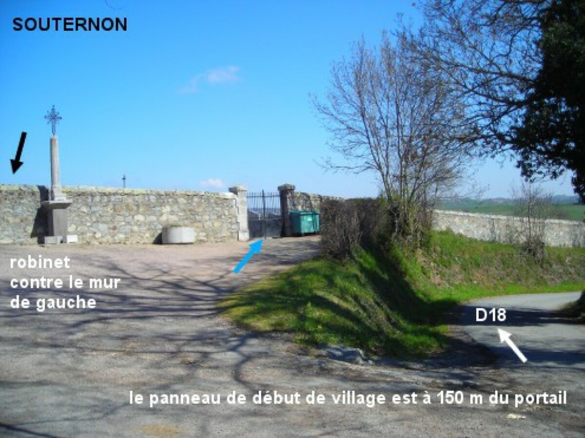
A partir de la D18 en provenance de Saint-Polgues, lorsque l'on aperçoit le panneau de début du village, tourner juste avant à droite (fléchage "cimetière"), le cimetière est 150 mètres plus loin, desservi par une allée à droite, à l'endroit où la petite route rejoint la rue Capus. Le robinet est à l'intérieur du cimetière, à gauche plus loin dans le coin.
Visual cues
Want to add a testimonial ?
There's no comment yet
Information
Warning: this site lists water points whose reliability can not be guaranteed. Before using a water point, you must ensure that there is no sign indicating that the water is not drinkable and do not infringe on private property.
If you find that no water is not potable, or not accessible, thank you to report it so that it is removed from the site.
If you find that no water is not potable, or not accessible, thank you to report it so that it is removed from the site.