Cemetery in Ouroux-sous-le-Bois-Sainte-Marie
Cemetery
| Town : | Ouroux-sous-le-Bois-Sainte-Marie (Saône-et-Loire) |
| Address : | D285 |
| Type : | Cemetery |
| Position : | 46.359263°N, 4.305953°E |
| Winter closure : oui | |
| Ce point d'eau a été ajouté par Erwan F en 2021 | |
Further information
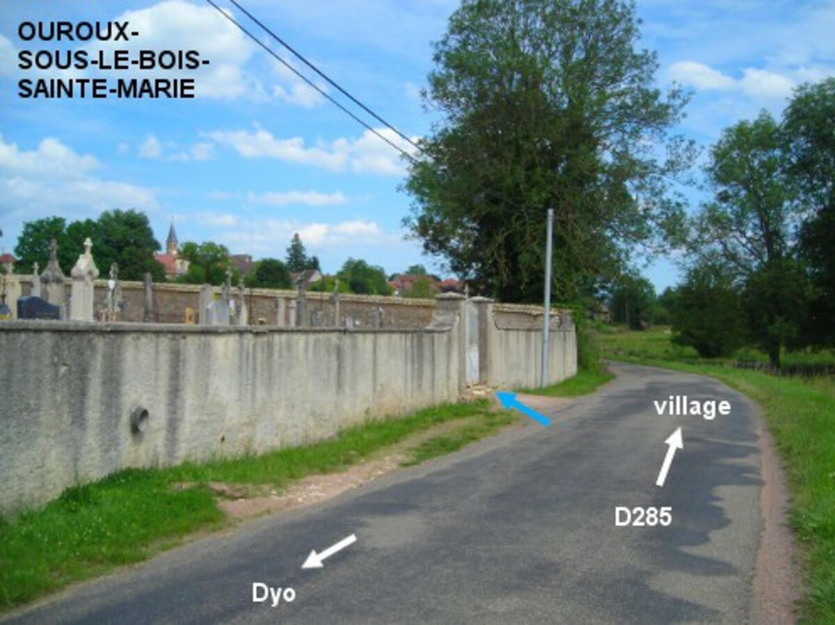
Le cimetière est situé en dehors du village, environ 200 mètres avant le panneau de début du village, côté gauche sur la D285 en direction de Colombier-en-Brionnais. Le robinet est à l'intérieur du cimetière, à droite du portail.
Visual cues
Want to add a testimonial ?
There's no comment yet
Information
Warning: this site lists water points whose reliability can not be guaranteed. Before using a water point, you must ensure that there is no sign indicating that the water is not drinkable and do not infringe on private property.
If you find that no water is not potable, or not accessible, thank you to report it so that it is removed from the site.
If you find that no water is not potable, or not accessible, thank you to report it so that it is removed from the site.