
Cemetery in La Tagnière
Cemetery
| Town : | La Tagnière (Saône-et-Loire) |
| Address : | Impasse des Dormants |
| Type : | Cemetery |
| Position : | 46.789568°N, 4.216193°E |
| Winter closure : information unknown | |
| Ce point d'eau a été ajouté par Erwan F en 2026 | |
Further information
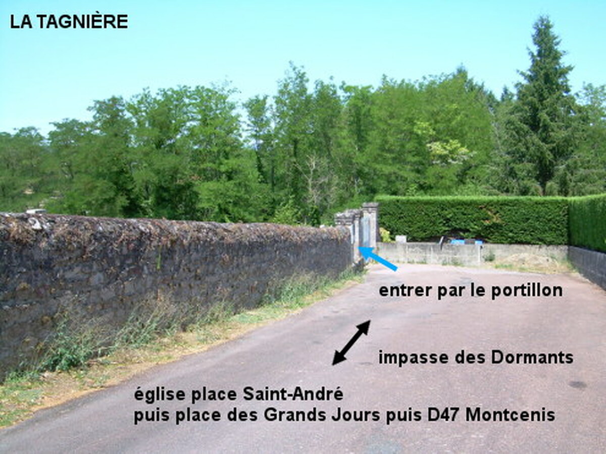
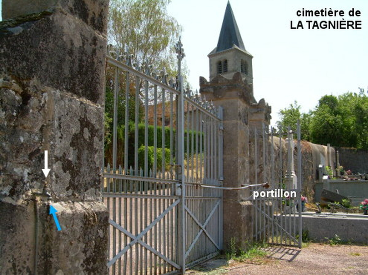
Le cimetière (fléché) se trouve au fond d'une impasse non loin de l'église, à 140 mètres de la D47 direction Montcenis. En provenance de Saint-Eugène sur la D224, à l'intersection avec la D47 tourner à droite dans la D47 direction Montcenis. Tourner dans la première à gauche (qui est une place) en direction du cimetière, ensuite on peut prendre indifféremment la branche gauche ou la branche droite du carrefour en Y qui se rejoignent sur la place située face au côté de l'église. Passer à gauche de l'église et rouler jusqu'au fond de l'impasse pour arriver vers le cimetière implanté côté gauche. Entrer par le portillon pour trouver le robinet à droite du portail lui-même à droite du portillon.
Visual cues
Want to add a testimonial ?
There's no comment yet
If you find that no water is not potable, or not accessible, thank you to report it so that it is removed from the site.