Cemetery in Sarry
Cemetery
| Town : | Sarry (Saône-et-Loire) |
| Address : | Chemin Sainte-Colombe |
| Type : | Cemetery |
| Position : | 46.313127°N, 4.119693°E |
| Winter closure : non | |
| Ce point d'eau a été ajouté par Erwan F en 2022 | |
Further information
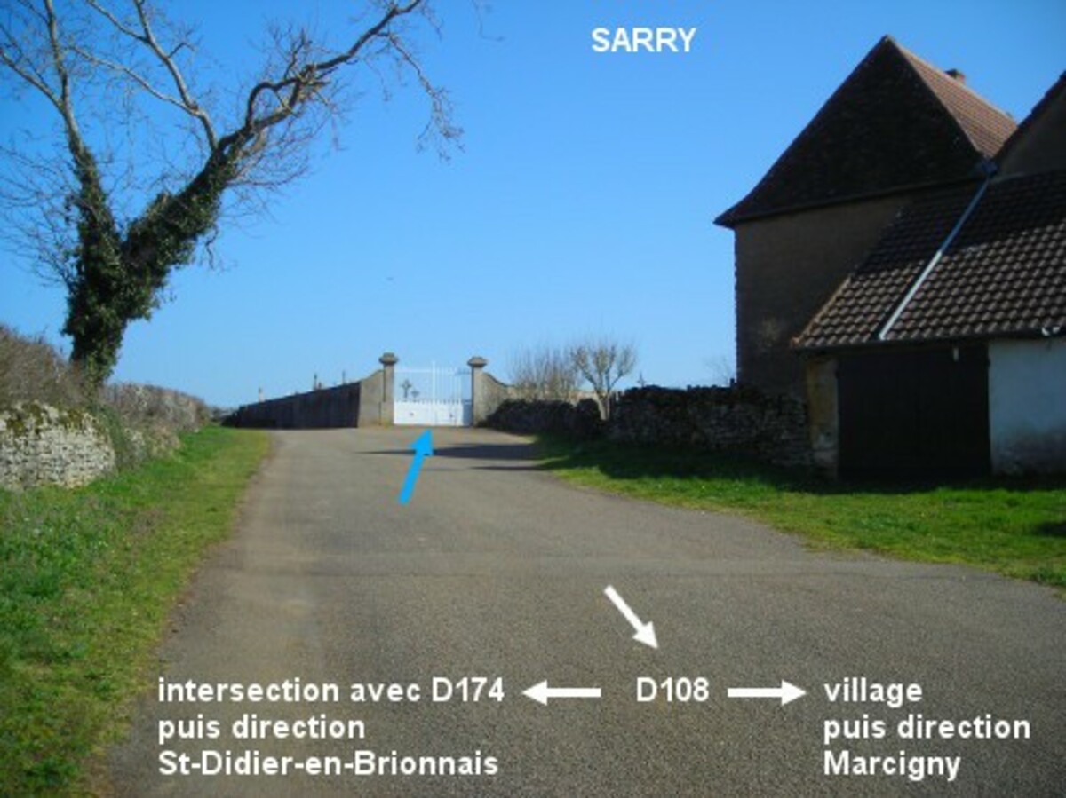
Le cimetière est situé en périphérie du village, à 180 mètres de la D108 et à 380 mètres de l'intersection D108 / D174. Sur la D108 en provenance de Saint-Didier-en-Brionnais, 200 mètres après l'intersection à gauche avec la D174 direction Briant (à cet endroit, on voit sur la droite un grand plan d'eau et une immense bâtisse), au niveau du panneau au début du village tourner à gauche (attention : virage en épingle !) et grimper jusqu'au cimetière (il n'y a pas de fléchage) qui est implanté côté droit. Le robinet est à l'intérieur du cimetière, à droite du portail.
Visual cues
Want to add a testimonial ?
There's no comment yet
Information
Warning: this site lists water points whose reliability can not be guaranteed. Before using a water point, you must ensure that there is no sign indicating that the water is not drinkable and do not infringe on private property.
If you find that no water is not potable, or not accessible, thank you to report it so that it is removed from the site.
If you find that no water is not potable, or not accessible, thank you to report it so that it is removed from the site.