Cemetery in Le Rousset
Cemetery
| Town : | Le Rousset (Saône-et-Loire) |
| Address : | Chemin de l'église |
| Type : | Cemetery |
| Position : | 46.571944°N, 4.465462°E |
| Winter closure : information unknown | |
| Ce point d'eau a été ajouté par Erwan F en 2022 | |
Further information
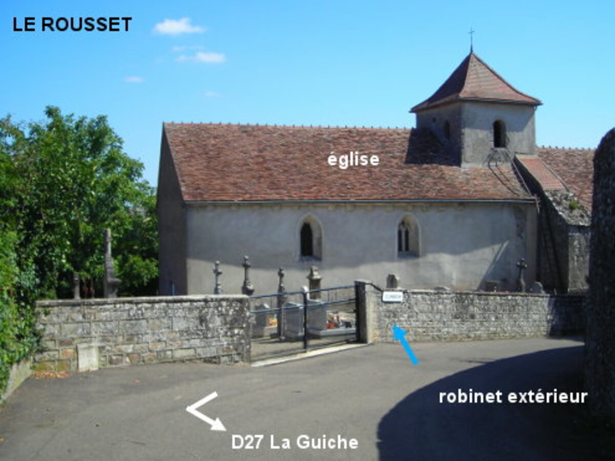
Le cimetière est implanté autour de l'église, à 80 mètres de la D27. Sur la D27 en direction de La Guiche, au niveau d'un virage à droite prononcé repérable au panneau à chevrons bleus et blancs, tourner à gauche en direction de l'église et suivre la rue à droite pour arriver en vue du cimetière. Celui-ci est implanté côté gauche. Le robinet est sur le mur extérieur du cimetière, à droite du portail. N.B. : Dans l'autre sens de circulation, le point de repère est aussi un panneau à chevrons de virage dangereux (virage à gauche), implanté donc côté droit. Là, tourner à droite en direction de l'église.
Visual cues
Want to add a testimonial ?
There's no comment yet
Information
Warning: this site lists water points whose reliability can not be guaranteed. Before using a water point, you must ensure that there is no sign indicating that the water is not drinkable and do not infringe on private property.
If you find that no water is not potable, or not accessible, thank you to report it so that it is removed from the site.
If you find that no water is not potable, or not accessible, thank you to report it so that it is removed from the site.