Cemetery in Saint-Ignat
Cemetery
| Town : | Saint-Ignat (Puy-de-Dôme) |
| Address : | Route de Maringues (D17) |
| Type : | Cemetery |
| Position : | 45.923007°N, 3.278487°E |
| Winter closure : oui | |
| Ce point d'eau a été ajouté par Erwan F en 2023 | |
Further information
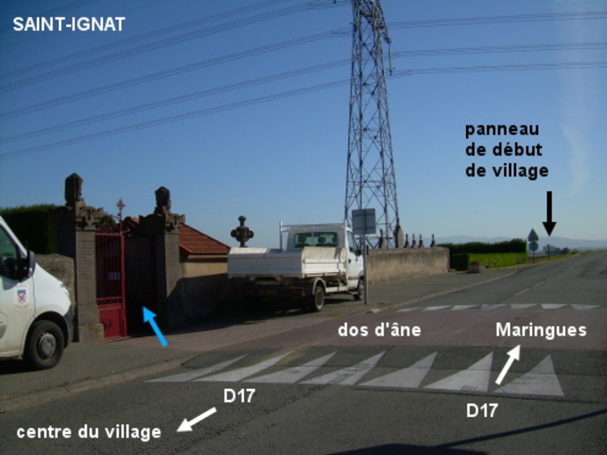
Le cimetière est implanté côté gauche à la sortie du village sur la D17 direction Maringues, 60 mètres avant le panneau de fin de village. Il est presque sous une ligne Haute-Tension et il y a un dos d'âne en face de son portail. Le robinet est à l'intérieur du cimetière à droite du portail, sur le mur du cabanon qui est immédiatement à droite.
Visual cues
Want to add a testimonial ?
There's no comment yet
Information
Warning: this site lists water points whose reliability can not be guaranteed. Before using a water point, you must ensure that there is no sign indicating that the water is not drinkable and do not infringe on private property.
If you find that no water is not potable, or not accessible, thank you to report it so that it is removed from the site.
If you find that no water is not potable, or not accessible, thank you to report it so that it is removed from the site.