Cemetery in Le Bois-d'Oingt
Cemetery
| Town : | Le Bois-d'Oingt (Rhône) |
| Address : | Chemin du Vieux Cimetière et chemin de Saint-Roch |
| Type : | Cemetery |
| Position : | 45.926558°N, 4.575756°E |
| Winter closure : oui | |
| Information : Cette eau est indiquée par un écriteau comme étant potable | |
| Ce point d'eau a été ajouté par Erwan F en 2025 | |
Further information
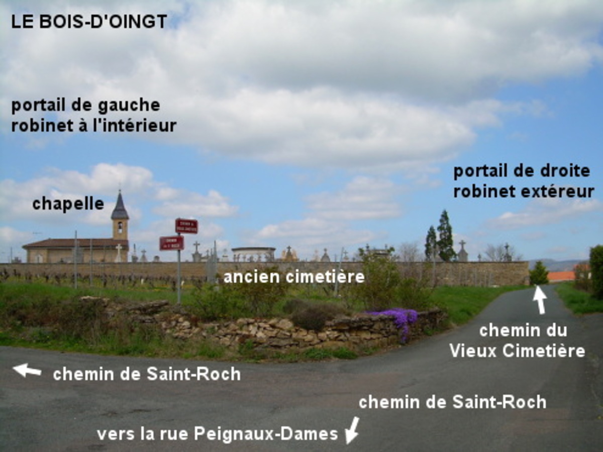
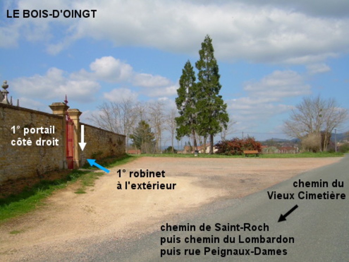
L'ancien cimetière est situé dans une rue secondaire à 960 mètres de la D120. En provenance du lieu-dit Les Ponts-Tarrets sur la D120, quand on arrive au niveau de l'église érigée côté droit, tourner à gauche dans la rue Peignaux-Dames (sens interdit sauf vélos). Au carrefour en croix, prendre en face le chemin du Lombardon en suivant la flèche ''ancien cimetière'', puis à droite (en Y) le chemin de Saint-Roch. On arrive ensuite à un carrefour dans la fourche duquel on voit au loin le cimetière avec une chapelle en son milieu. 1a) Si on passe par la droite, donc en prenant tout droit le chemin du Vieux Cimetière, on arrivera 100 mètres plus loin à côté du premier portail et du premier robinet qui est à l'extérieur à sa droite. 1b) Si on passe par la gauche, en continuant dans le chemin de Saint-Roch qui tourne à gauche, on arrivera 100 mètres plus loin à côté du deuxième portail. N.B. : Celui-ci n'est pas très commode à ouvrir (il faut passer la main à travers les barreaux pour manœuvrer la tirette à ressort et débloquer ainsi le battant droit tout en poussant très fort sur ce battant pour l'ouvrir). Le deuxième robinet est à l'intérieur du cimetière, derrière la croix à huit pas sur la gauche, et il est surmonté d'un écriteau bleu ''eau potable''.
Visual cues
Want to add a testimonial ?
There's no comment yet
If you find that no water is not potable, or not accessible, thank you to report it so that it is removed from the site.