Cemetery in Moiré
Cemetery
| Town : | Moiré (Rhône) |
| Address : | Rue des Lavandières |
| Type : | Cemetery |
| Position : | 45.927594°N, 4.601489°E |
| Winter closure : oui | |
| Ce point d'eau a été ajouté par Erwan F en 2025 | |
Further information
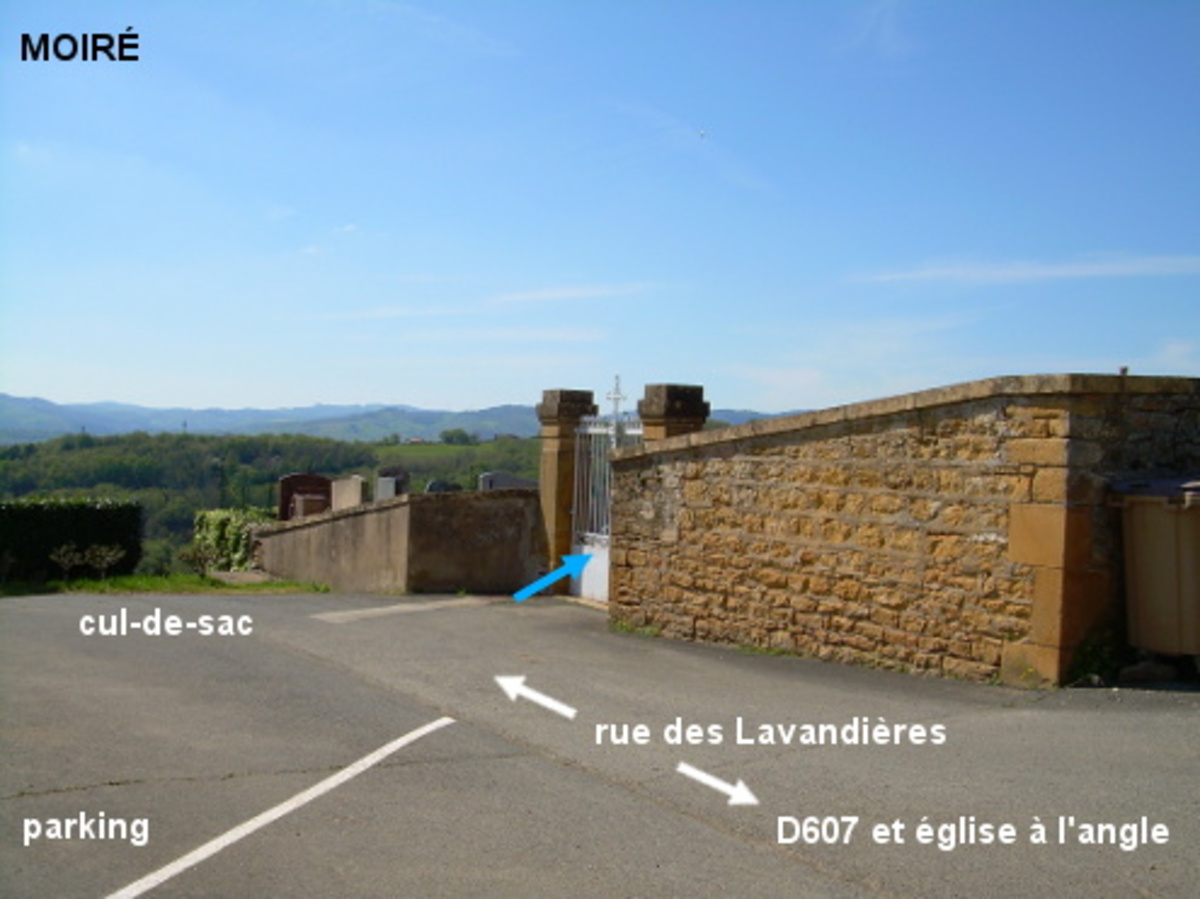
Le cimetière est implanté au bout d'une impasse qui débute à côté de l'église. Le robinet est à l'intérieur du cimetière à gauche du portail. En provenance de Frontenas sur la D607, juste avant l'église érigée côté gauche, tourner à gauche dans la rue en impasse (cf pictogramme ad-hoc, il y a aussi un panneau bleu de parking). Rouler 160 mètres jusqu'au portail du cimetière implanté côté droit à l'extrémité de cette impasse.
Visual cues
Want to add a testimonial ?
There's no comment yet
Information
Warning: this site lists water points whose reliability can not be guaranteed. Before using a water point, you must ensure that there is no sign indicating that the water is not drinkable and do not infringe on private property.
If you find that no water is not potable, or not accessible, thank you to report it so that it is removed from the site.
If you find that no water is not potable, or not accessible, thank you to report it so that it is removed from the site.